
1891 Map of Spanish Peaks
USGS Topo · Published 1891About this map
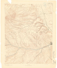
Trinidad serves as the focal point of this 1889 survey, situated at the confluence of the Purgatoire River and various canyons that define the local drainage. The town's significance as a regional hub is reflected in the concentration of surrounding settlements such as Sopris, Starkville, and Madrid. The industrial and transit infrastructure of the era is anchored by the Denver Texas and Fort Worth Railroad, which snakes through the eastern terrain passing through Chicosa and Barne.
Find a feature on this map
31 named features on this map. Tap any name to fly to it.
Don’t see what you’re looking for? This feature index may not catch every label — zoom into the map to look around manually.
Map Details
Editions of this 1891 Spanish Peaks Map
2 editions found
Other maps of this area

1889 · Huerfano Park
USGS Topo · 1:125,000

1891 · Walsenburg
USGS Topo · 1:125,000

1891 · Apishapa
USGS Topo · 1:125,000

1892 · Huerfano Park
USGS Topo · 1:125,000

1892 · Elmoro
USGS Topo · 1:125,000

1893 · Spanish Peaks
USGS Topo · 1:125,000

1893 · Apishapa
USGS Topo · 1:125,000

1893 · Elmoro
USGS Topo · 1:125,000

1894 · Walsenburg
USGS Topo · 1:125,000

1895 · Spanish Peaks
USGS Topo · 1:125,000