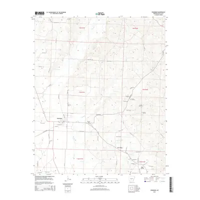
2014 Map of Sparkman
USGS Topo · Published 2014About this map
Sparkman serves as the central hub of this Dallas County landscape, where the local grid meets a network of timber and farm roads. The town's surroundings are defined by the winding paths of Cypress Cr and Brushy Cr, creating a broken terrain that has long shaped settlement patterns in this part of Arkansas. Beyond the main townsite, smaller communities like New Hope and Pine Grove are identified, often centered around long-standing landmarks such as the Mt Carmel Cem.
Find a feature on this map
62 named features on this map. Tap any name to fly to it.
Don’t see what you’re looking for? This feature index may not catch every label — zoom into the map to look around manually.
Map Details
Editions of this 2014 Sparkman Map
This is the sole edition of this map. No revisions or reprints were ever made.
Other maps of this area

1903 · Camden
USGS Topo · 1:125,000

1953 · El Dorado
USGS Topo · 1:250,000

1955 · Little Rock
USGS Topo · 1:250,000

1956 · Little Rock
USGS Topo · 1:250,000

1957 · El Dorado
USGS Topo · 1:250,000

1958 · El Dorado
USGS Topo · 1:250,000

1960 · El Dorado
USGS Topo · 1:250,000

1960 · Little Rock
USGS Topo · 1:250,000

1964 · Little Rock
USGS Topo · 1:250,000
1965 · Dalark
USGS Topo · 1:24,000