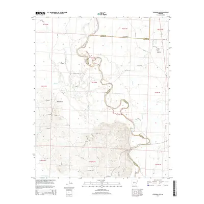
2014 Map of Sparkman NW
USGS Topo · Published 2014About this map
The Ouachita River meanders sharply through this territory, carving a complex boundary between Clark and Dallas Counties. The river's winding course creates landforms like Daughty Island and feeds a system of backwaters including White Oak Slough, Long Lake, and Round Lake. This landscape is defined by the intersection of river bottomlands and the network of local roads that connect small communities such as Shakertown and Fairview. Local history is anchored at the Centerpoint Cem near Fairview, while several creeks like Deceiver Cr, Cypress Cr, and Terre Noire Cr drain the surrounding woods. The map reflects a rural geography where township and range lines meet an intricate drainage system, preserving the layout of homesteads and connector routes like Vaden Rd and Malvern Camp Rd.
Find a feature on this map
62 named features on this map. Tap any name to fly to it.
Don’t see what you’re looking for? This feature index may not catch every label — zoom into the map to look around manually.
Map Details
Editions of this 2014 Sparkman NW Map
This is the sole edition of this map. No revisions or reprints were ever made.
Other maps of this area

1901 · Gurdon
USGS Topo · 1:125,000

1903 · Camden
USGS Topo · 1:125,000

1953 · El Dorado
USGS Topo · 1:250,000

1955 · Little Rock
USGS Topo · 1:250,000

1956 · Little Rock
USGS Topo · 1:250,000

1957 · El Dorado
USGS Topo · 1:250,000

1958 · El Dorado
USGS Topo · 1:250,000

1959 · Arkadelphia
USGS Topo · 1:24,000

1960 · El Dorado
USGS Topo · 1:250,000

1960 · Little Rock
USGS Topo · 1:250,000