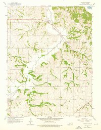
1959 Map of Sparks
USGS Topo · Published 1976About this map
The Iowa Sac and Fox Indian Mission stands at the northwestern corner of this landscape, marking a significant cultural and historical intersection in Doniphan County. The 1950s terrain is defined by the winding course of the Wolf River and its numerous tributaries, including Striker Branch and Pennell Creek, which carve through the undulating loess hills of northeastern Kansas. Small rural centers like Sparks and Fanning serve as anchors for the surrounding agricultural community, while the Union Pacific and Chicago Rock Island and Pacific railroads provide the vital infrastructure that linked these settlements to larger markets. Educational and memorial sites are frequent across the township, from the Buffalo Sch in the north to the Zimmerman Sch in the south, reflecting a densely settled rural landscape before the consolidation of the late 20th century. Along the eastern edge, a levee protects the lowlands near the Missouri River, where a Landing Field indicates early regional aviation activity.
Find a feature on this map
36 named features on this map. Tap any name to fly to it.
Don’t see what you’re looking for? This feature index may not catch every label — zoom into the map to look around manually.
Map Details
Editions of this 1959 Sparks Map
2 editions found
Other maps of this area

1885 · Atchison
USGS Topo · 1:125,000

1888 · Atchison
USGS Topo · 1:125,000

1893 · Atchison
USGS Topo · 1:125,000

1926 · Atchison
USGS Topo · 1:62,500

1926 · Oregon
USGS Topo · 1:62,500

1950 · Kansas City
USGS Topo · 1:250,000

1954 · Kansas City
USGS Topo · 1:250,000

1956 · Kansas City
USGS Topo · 1:250,000
1959 · Oregon
USGS Topo · 1:24,000
1959 · White Cloud
USGS Topo · 1:24,000