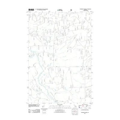
2011 Map of Sparrow Rapids
USGS Topo · Published 2011About this map
The East Branch Ontonagon River carves a winding path through this northern Michigan landscape, define by a dense network of tributaries and remote forest tracts. This early 21st-century survey highlights the intricate hydrology of the region, including notable features such as Onion Falls and the scattered Davidson Lakes. The land is crisscrossed by forest infrastructure, notably Forest Service Rd 1100 and Nat For Dev Rd 16 N, which provide access to interior points like the Sparrow Rapids Campground. Local elevation is anchored by the Connors Lookout Tower, a landmark overlooking the drainages of Connors Creek and York Lake. The distribution of named creeks, from Skoglund Creek to Burlitts Creek, illustrates the complex watershed that feeds the Ontonagon system, a vital part of the Upper Peninsula’s wilderness character.
Find a feature on this map
22 named features on this map. Tap any name to fly to it.
Don’t see what you’re looking for? This feature index may not catch every label — zoom into the map to look around manually.
Map Details
Editions of this 2011 Sparrow Rapids Map
This is the sole edition of this map. No revisions or reprints were ever made.
Other maps of this area

1949 · Rockland
USGS Topo · 1:62,500

1951 · Rockland
USGS Topo · 1:62,500

1952 · Watersmeet
USGS Topo · 1:62,500

1954 · Rousseau
USGS Topo · 1:62,500

1954 · Kenton
USGS Topo · 1:62,500

1958 · Iron River
USGS Topo · 1:250,000

1960 · Iron River
USGS Topo · 1:250,000

1961 · Iron River
USGS Topo · 1:250,000

1967 · Iron River
USGS Topo · 1:250,000

1979 · Ontonagon
USGS Topo · 1:100,000