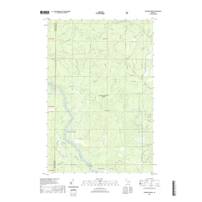
2019 Map of Sparrow Rapids
USGS Topo · Published 2019About this map
The West Branch Ontonagon River carves through the heart of this landscape, designated here as the Ontonagon Wild and Scenic River. Located within the Ottawa National Forest along the border of Houghton and Ontonagon counties, the area is defined by its complex network of waterways and forest service trails. The southern portion of the quadrangle is punctuated by the Davidson Lakes and the winding course of Beaver Cr, while the northern terrain is fed by numerous tributaries including Skoglund Cr and Kits Cr. A notable landmark for those tracing local geography is Onion Falls, situated where Onion Cr moves through the timberland. This 2019 survey documents a preserved wilderness corridor, showing the extensive system of National Forest System Trails like Nfst-1439 and Nfst-1130 that provide access to remote water bodies like Duck Lake and York Lake.
Find a feature on this map
79 named features on this map. Tap any name to fly to it.
Don’t see what you’re looking for? This feature index may not catch every label — zoom into the map to look around manually.
Map Details
Editions of this 2019 Sparrow Rapids Map
This is the sole edition of this map. No revisions or reprints were ever made.
Other maps of this area

1949 · Rockland
USGS Topo · 1:62,500

1951 · Rockland
USGS Topo · 1:62,500

1952 · Watersmeet
USGS Topo · 1:62,500

1954 · Rousseau
USGS Topo · 1:62,500

1954 · Kenton
USGS Topo · 1:62,500

1958 · Iron River
USGS Topo · 1:250,000

1960 · Iron River
USGS Topo · 1:250,000

1961 · Iron River
USGS Topo · 1:250,000

1967 · Iron River
USGS Topo · 1:250,000

1979 · Ontonagon
USGS Topo · 1:100,000