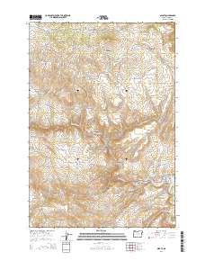
2014 Map of Sparta
USGS Topo · Published 2014About this map
Sparta sits atop the high plateau of Baker County, serving as the primary landmark in this survey of the high desert and canyonlands of eastern Oregon. The settlement is anchored by Sparta Cem and a network of local routes like Gem Mine Rd and Sparta Ln, reflecting the area's extraction-based history. The landscape is defined by a complex drainage system where steep gulches like Maiden Gulch and Rattlesnake Gulch carry seasonal flows toward the Powder River in the south.
Find a feature on this map
51 named features on this map. Tap any name to fly to it.
Don’t see what you’re looking for? This feature index may not catch every label — zoom into the map to look around manually.
Map Details
Editions of this 2014 Sparta Map
This is the sole edition of this map. No revisions or reprints were ever made.
Other maps of this area

1915 · Pine
USGS Topo · 1:125,000

1955 · Baker
USGS Topo · 1:250,000

1957 · Halfway
USGS Topo · 1:62,500

1957 · Sparta
USGS Topo · 1:62,500

1957 · Durkee
USGS Topo · 1:62,500

1957 · Mineral
USGS Topo · 1:62,500

1959 · Baker
USGS Topo · 1:250,000

1981 · Baker
USGS Topo · 1:100,000
1987 · Richland
USGS Topo · 1:24,000
1987 · Jimtown
USGS Topo · 1:24,000