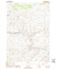
1988 Map of Sparta
USGS Topo · Published 1988About this map
Sparta serves as the focal point of this Baker County landscape, situated amidst a terrain defined by deep gulches and an intensive history of extraction. Gold mining activity is evident throughout the region, with numerous workings such as the Rosebud Mine, Del Monte Mine, and Crystal Palace Mine scattered across the uplands north of the river. The settlement includes its own Cem, indicating the long-term residency of the mining and ranching families who worked these claims.
Find a feature on this map
42 named features on this map. Tap any name to fly to it.
Don’t see what you’re looking for? This feature index may not catch every label — zoom into the map to look around manually.
Map Details
Editions of this 1988 Sparta Map
This is the sole edition of this map. No revisions or reprints were ever made.
Other maps of this area

1915 · Pine
USGS Topo · 1:125,000

1955 · Baker
USGS Topo · 1:250,000

1957 · Halfway
USGS Topo · 1:62,500

1957 · Sparta
USGS Topo · 1:62,500

1957 · Durkee
USGS Topo · 1:62,500

1957 · Mineral
USGS Topo · 1:62,500

1959 · Baker
USGS Topo · 1:250,000

1981 · Baker
USGS Topo · 1:100,000
1987 · Richland
USGS Topo · 1:24,000
1987 · Jimtown
USGS Topo · 1:24,000