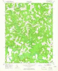
1951 Map of Sparta
USGS Topo · Published 1966About this map
Sparta and the surrounding crossroads of Caroline County appear here during a period of steady mid-century rural life, anchored by small community centers and an intricate network of waterways. The landscape is defined by the winding course of the Mattaponi River to the south and the swampy bottomlands of Maracossic Creek and Beverly Run. These water sources supported local industry and agriculture, evidenced by Broadus Mill Pond and Byrds Mill Pond.
Find a feature on this map
34 named features on this map. Tap any name to fly to it.
Don’t see what you’re looking for? This feature index may not catch every label — zoom into the map to look around manually.
Map Details
Editions of this 1951 Sparta Map
2 editions found
Other maps of this area

1889 · Fredericksburg
USGS Topo · 1:125,000

1892 · Fredericksburg
USGS Topo · 1:125,000

1894 · Fredericksburg
USGS Topo · 1:125,000

1918 · Doswell
USGS Topo · 1:62,500

1918 · Aylett
USGS Topo · 1:62,500

1933 · Aylett
USGS Topo · 1:62,500

1942 · Bowling Green
USGS Topo · 1:31,680

1942 · Upper Zion
USGS Topo · 1:31,680

1942 · Occupacia
USGS Topo · 1:31,680

1943 · Richmond
USGS Topo · 1:250,000