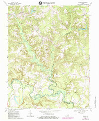
1968 Map of Sparta
USGS Topo · Published 1985About this map
The Mattaponi River forms the southern boundary of this region, meandering through dense lowlands where Caroline, King and Queen, and King William counties meet. This rural Virginia landscape is defined by its intricate drainage networks, where Maracossic Creek and Beverly Run feed into the river system. Settlement patterns are focused around small crossroads and family-named landforms, with villages like Sparta and Central Point serving as local hubs. The importance of early water-powered industry is visible in Jiles Millpond and Byrds Millpond, which represent the historical reliance on local milling. Numerous country churches, including Salem Ch and Jerusalem Ch, anchor the community, while scattered Gravel Pits indicate the area's geological resource extraction during the mid-20th century.
Find a feature on this map
32 named features on this map. Tap any name to fly to it.
Don’t see what you’re looking for? This feature index may not catch every label — zoom into the map to look around manually.
Map Details
Editions of this 1968 Sparta Map
2 editions found
Other maps of this area

1889 · Fredericksburg
USGS Topo · 1:125,000

1892 · Fredericksburg
USGS Topo · 1:125,000

1894 · Fredericksburg
USGS Topo · 1:125,000

1918 · Doswell
USGS Topo · 1:62,500

1918 · Aylett
USGS Topo · 1:62,500

1933 · Aylett
USGS Topo · 1:62,500

1942 · Bowling Green
USGS Topo · 1:31,680

1942 · Upper Zion
USGS Topo · 1:31,680

1942 · Occupacia
USGS Topo · 1:31,680

1943 · Richmond
USGS Topo · 1:250,000