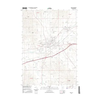
2016 Map of Sparta
USGS Topo · Published 2016About this map
Sparta serves as the central hub on this 2016 survey, situated at the confluence of the La Crosse River and several of its tributaries. The landscape is defined by the transitions between the broad Leon Valley and the more varied terrain of Putnam Ridge and Balls Bluff. This map provides a detailed view of the regional cemetery network, documenting sites such as Woodlawn Cem, Saint Patricks Cem, and the rural Farmers Valley Cem. To the north, Angelo Pond marks a significant water feature near the settlement of Angelo, while the southern reaches follow the path of the Little La Crosse River through Leon. The presence of these family burial grounds alongside the intricate creek systems like Beaver Cr highlights the deep-rooted agricultural and community history of Monroe County.
Find a feature on this map
142 named features on this map. Tap any name to fly to it.
Don’t see what you’re looking for? This feature index may not catch every label — zoom into the map to look around manually.
Map Details
Editions of this 2016 Sparta Map
This is the sole edition of this map. No revisions or reprints were ever made.
Other maps of this area

1909 · Sparta
USGS Topo · 1:62,500

1916 · Tomah
USGS Topo · 1:62,500

1928 · Melrose
USGS Topo · 1:48,000

1947 · Millston
USGS Topo · 1:62,500

1947 · Sparta
USGS Topo · 1:62,500

1949 · Millston
USGS Topo · 1:62,500

1949 · Sparta
USGS Topo · 1:62,500

1949 · Tomah
USGS Topo · 1:62,500

1949 · Melrose
USGS Topo · 1:62,500

1953 · Eau Claire
USGS Topo · 1:250,000