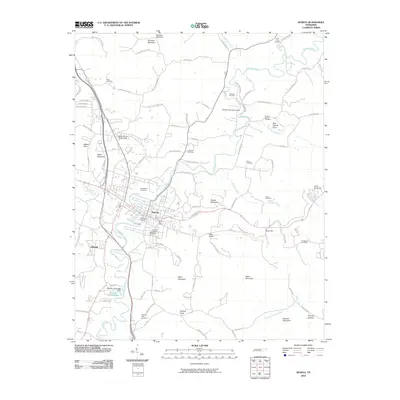
2010 Map of Sparta
USGS Topo · Published 2010About this map
The Calfkiller River snakes through the center of this White County landscape, anchoring the city of Sparta as it appeared in the early 21st century. The map reveals a dense network of local history, particularly through its numerous burial grounds like the Old Sparta Cemetery and Highland Cemetery near the town center, and the New Blue Springs Cemetery to the north. These sites, along with the White County Fairgrounds, point to a long-established community structure centered around the river valley and the surrounding highlands.
Find a feature on this map
99 named features on this map. Tap any name to fly to it.
Don’t see what you’re looking for? This feature index may not catch every label — zoom into the map to look around manually.
Map Details
Editions of this 2010 Sparta Map
This is the sole edition of this map. No revisions or reprints were ever made.
Other maps of this area

1892 · Pikeville
USGS Topo · 1:125,000

1893 · Mc Minnville
USGS Topo · 1:125,000

1895 · Mc Minnville
USGS Topo · 1:125,000

1895 · Pikeville
USGS Topo · 1:125,000

1897 · Standingstone
USGS Topo · 1:125,000

1898 · Standingstone
USGS Topo · 1:125,000

1943 · Cookeville
USGS Topo · 1:100,000

1944 · Cookeville
USGS Topo · 1:100,000

1953 · Chattanooga
USGS Topo · 1:250,000

1954 · De Rossett
USGS Topo · 1:24,000