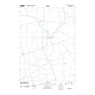
2010 Map of Spartansburg
USGS Topo · Published 2010About this map
Spartansburg serves as the central hub of this Crawford County landscape, situated where the waters of Clear Lake are controlled by the Clear Lake Dam. The settlement pattern is defined by several rural crossroads, including Concord Corners, Blakeslee Corners, and Merchant Corners, which emphasize the historical importance of local road junctions in this agricultural region. The terrain is marked by gradual elevation changes like Eastman Hill, drained by a network of waterways such as Fivemile Creek and the East Branch Oil Creek. Local genealogy and land use history are well-represented through multiple burial grounds, including Rose Hill Cemetery and Woodlawn Cemetery, alongside smaller settlements like Hatchtown and Fish Flats that anchor the surrounding townships.
Find a feature on this map
59 named features on this map. Tap any name to fly to it.
Don’t see what you’re looking for? This feature index may not catch every label — zoom into the map to look around manually.
Map Details
Editions of this 2010 Spartansburg Map
This is the sole edition of this map. No revisions or reprints were ever made.
Other maps of this area

1927 · Townville
USGS Topo · 1:48,000

1927 · Titusville
USGS Topo · 1:62,500

1929 · Corry
USGS Topo · 1:48,000

1929 · Union City
USGS Topo · 1:62,500

1932 · Corry
USGS Topo · 1:62,500

1932 · Townville
USGS Topo · 1:62,500

1932 · Union City
USGS Topo · 1:62,500

1933 · Titusville
USGS Topo · 1:62,500

1945 · Townville
USGS Topo · 1:62,500

1957 · Warren
USGS Topo · 1:250,000