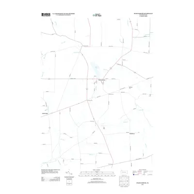
2013 Map of Spartansburg
USGS Topo · Published 2013About this map
Spartansburg serves as the central hub of this Crawford County landscape, where the waters of Clear Lake transition into Patrick Run and eventually the E Br Oil Cr. The map reveals a dense network of early rural settlements and namesake intersections, including Concord Corners, Blakeslee Corners, and Merchant Corners, indicating a well-distributed agricultural community. The terrain is marked by distinct rises such as Eastman Hill and the branching waterways of Fivemile Cr and Britton Run. These features suggest a history of localized commerce at sites like Fish Flats and Hatchtown, where the intersection of regional roads and creeks shaped the development of the valley. Genealogists and local historians can trace the distribution of homesteads along old routes like Welch Hill Rd and Erie Co Line Rd, which connect these small, persistent hamlets.
Find a feature on this map
81 named features on this map. Tap any name to fly to it.
Don’t see what you’re looking for? This feature index may not catch every label — zoom into the map to look around manually.
Map Details
Editions of this 2013 Spartansburg Map
This is the sole edition of this map. No revisions or reprints were ever made.
Other maps of this area

1927 · Townville
USGS Topo · 1:48,000

1927 · Titusville
USGS Topo · 1:62,500

1929 · Corry
USGS Topo · 1:48,000

1929 · Union City
USGS Topo · 1:62,500

1932 · Corry
USGS Topo · 1:62,500

1932 · Townville
USGS Topo · 1:62,500

1932 · Union City
USGS Topo · 1:62,500

1933 · Titusville
USGS Topo · 1:62,500

1945 · Townville
USGS Topo · 1:62,500

1957 · Warren
USGS Topo · 1:250,000