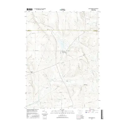
2016 Map of Spartansburg
USGS Topo · Published 2016About this map
Spartansburg serves as the central hub for this portion of northeastern Crawford County, situated where the E Br Oil Cr flows through the lowlands north of Fish Flats. The landscape is characterized by a network of rural routes connecting small settlements like Britton Run and Hatchtown. Water features define the local geography, from the expansion of Clear Lake just north of the borough to the numerous winding waterways such as Fivemile Cr and Brandy Run. Genealogists will find several burial sites preserved across these hills and valleys, including Rose Hill Cem at the town's edge and the more isolated Woodlawn Cem and Whitney Cem. Significant elevation changes are marked by Eastman Hill to the east, overlooking the agricultural valleys that have long shaped the region's character.
Find a feature on this map
60 named features on this map. Tap any name to fly to it.
Don’t see what you’re looking for? This feature index may not catch every label — zoom into the map to look around manually.
Map Details
Editions of this 2016 Spartansburg Map
This is the sole edition of this map. No revisions or reprints were ever made.
Other maps of this area

1927 · Townville
USGS Topo · 1:48,000

1927 · Titusville
USGS Topo · 1:62,500

1929 · Corry
USGS Topo · 1:48,000

1929 · Union City
USGS Topo · 1:62,500

1932 · Corry
USGS Topo · 1:62,500

1932 · Townville
USGS Topo · 1:62,500

1932 · Union City
USGS Topo · 1:62,500

1933 · Titusville
USGS Topo · 1:62,500

1945 · Townville
USGS Topo · 1:62,500

1957 · Warren
USGS Topo · 1:250,000