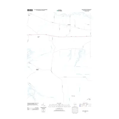
2013 Map of Spaulding
USGS Topo · Published 2013About this map
The East Fork Black River meanders through this portion of Jackson County, anchoring a landscape defined by its complex hydrology and timbered terrain. Small settlements like Spaulding and Pray are situated along the historic corridor of Old Hwy 54, while Lapham Junction marks a key intersection further south. The region's geography is characterized by engineered water systems, including the North Floater Ditch, South Floater Ditch, and Hunters Peak Ditch, which drain the lowlands surrounding Drescher Island. Prominent landmarks such as Sugarloaf Mound and Bear Bluff rise above the wetlands, providing distinct vertical relief. The proximity of Potter Flowage and the courses of Morrison Cr and McKenna Cr highlight the vital role of water management and natural drainage in shaping the local economy and land use during the early 21st century.
Find a feature on this map
32 named features on this map. Tap any name to fly to it.
Don’t see what you’re looking for? This feature index may not catch every label — zoom into the map to look around manually.
Map Details
Editions of this 2013 Spaulding Map
This is the sole edition of this map. No revisions or reprints were ever made.
Other maps of this area

1947 · Millston
USGS Topo · 1:62,500

1949 · Millston
USGS Topo · 1:62,500

1953 · Eau Claire
USGS Topo · 1:250,000

1957 · City Point
USGS Topo · 1:48,000

1958 · Eau Claire
USGS Topo · 1:250,000

1958 · Hatfield
USGS Topo · 1:48,000

1958 · Wyeville
USGS Topo · 1:48,000

1964 · Eau Claire
USGS Topo · 1:250,000

1970 · City Point NE
USGS Topo · 1:24,000
1970 · Mather
USGS Topo · 1:24,000