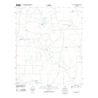
2010 Map of Speck Mountain
USGS Topo · Published 2010About this map
Rockwood sits at the southwestern edge of this landscape, where the local road network converges near Camp Creek. The terrain is defined by the winding course of Home Creek, which snakes across the central quadrangle toward the prominent Horseshoe Bend. This area of Coleman County reflects a legacy of water management and land use, evidenced by numerous Soil Conservation Service infrastructure projects like Soil Conservation Service Site 18 Reservoir and several associated dams. The presence of Stewardson Cemetery and Five Ashes Cemetery provides essential touchpoints for genealogical research in this rural Texas interior. Named landmarks such as Speck Mountain and the La Vista Ranch highlight the ranching character of the region, while the intermittent flows of Dry Creek and Hay Creek illustrate the drainage patterns that have shaped local property lines and travel routes.
Find a feature on this map
35 named features on this map. Tap any name to fly to it.
Don’t see what you’re looking for? This feature index may not catch every label — zoom into the map to look around manually.
Map Details
Editions of this 2010 Speck Mountain Map
This is the sole edition of this map. No revisions or reprints were ever made.
Other maps of this area

1887 · Coleman
USGS Topo · 1:125,000

1889 · Coleman
USGS Topo · 1:125,000

1894 · Brady
USGS Topo · 1:125,000

1924 · Brady 2-a
USGS Topo · 1:48,000

1925 · Brady 2-b
USGS Topo · 1:48,000

1925 · Brady 1-b
USGS Topo · 1:48,000

1928 · Mercury
USGS Topo · 1:62,500

1928 · Waldrip
USGS Topo · 1:62,500

1950 · Mercury
USGS Topo · 1:62,500

1954 · Brownwood
USGS Topo · 1:250,000