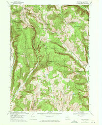
1969 Map of Speedsville
USGS Topo · Published 1971About this map
Shindagin Hollow and the surrounding woodlands of southern Caroline dominate this landscape, which spans the border between Tompkins Co Tioga Co. This 1960s perspective reveals a region defined by its conservation history, with thousands of acres preserved within Potato Hill State Forest, Shindagin Hollow State Forest, and Fairfield State Forest. Small rural hubs like Speedsville and Caroline Center remain the primary points of settlement, connected by historic thoroughfares such as Seventy Six Road.
Find a feature on this map
32 named features on this map. Tap any name to fly to it.
Don’t see what you’re looking for? This feature index may not catch every label — zoom into the map to look around manually.
Map Details
Editions of this 1969 Speedsville Map
2 editions found
Other maps of this area

1900 · Dryden
USGS Topo · 1:62,500

1901 · Apalachin
USGS Topo · 1:62,500

1903 · Owego
USGS Topo · 1:62,500

1903 · Harford
USGS Topo · 1:62,500

1904 · Apalachin
USGS Topo · 1:62,500

1906 · Catatonk
USGS Topo · 1:125,000

1949 · Ithaca East
USGS Topo · 1:24,000

1949 · Willseyville
USGS Topo · 1:24,000
1949 · Dryden
USGS Topo · 1:24,000

1949 · Speedsville
USGS Topo · 1:24,000