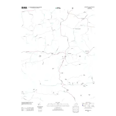
2013 Map of Speedwell
USGS Topo · Published 2013About this map
Speedwell serves as a central hub in this section of Wythe County, where the Grayson Tpke meets the meandering path of Cripple Cr. The landscape is defined by its deep hollows and prominent ridges, including the appropriately named Horse Heaven and Bowling Green Mountain. Historically significant routes like the Zion Church Rd and Old Bank Rd intersect the valley, connecting small settlements such as Rowe Crossroads and Simmerman. The southern portion of the map transitions into the high country of the Blue Ridge, featuring landmarks like High Knob and the recreational area around Hale Lake. These features imply a region shaped by subsistence farming and timber in the earlier years, evolving into a landscape of quiet rural crossroads and forest service access by the early 21st century.
Find a feature on this map
73 named features on this map. Tap any name to fly to it.
Don’t see what you’re looking for? This feature index may not catch every label — zoom into the map to look around manually.
Map Details
Editions of this 2013 Speedwell Map
This is the sole edition of this map. No revisions or reprints were ever made.
Other maps of this area

1889 · Wytheville
USGS Topo · 1:125,000

1892 · Wytheville
USGS Topo · 1:125,000

1930 · Speedwell
USGS Topo · 1:62,500

1930 · Independence
USGS Topo · 1:48,000

1931 · Rural Retreat
USGS Topo · 1:48,000

1933 · Independence
USGS Topo · 1:62,500

1935 · Mouth of Wilson
USGS Topo · 1:48,000

1935 · Cedar Springs
USGS Topo · 1:24,000
1935 · Groseclose
USGS Topo · 1:24,000

1935 · Middle Fox Creek
USGS Topo · 1:24,000