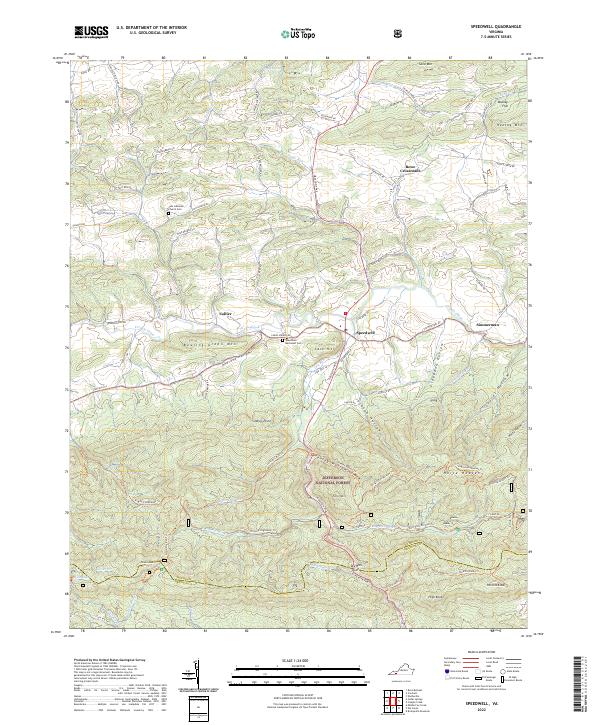
2022 Map of Speedwell
USGS Topo · Published 2022About this map
Cripple Creek winds through the valley floor of Wythe County, anchoring a landscape defined by small settlements and high mountain ridges. This 2022 survey captures the transition from the agricultural bottomlands near Speedwell and Collier to the protected heights of the Jefferson National Forest. The geography here is marked by significant elevation changes, with High Knob and Perkins Knob rising above deep drainages like Andrews Hollow and Jackson Hollow. Local heritage is preserved in the numerous cemeteries and churches that dot the roadsides, including the Zion Lutheran Church Cem and Speedwell Methodist Cem. The southern portion of the map transitions into the high country of the Wythe and Grayson county line, where the Virginia Highlands Trl traverses the remote terrain of Horse Heaven.
Find a feature on this map
77 named features on this map. Tap any name to fly to it.
Don’t see what you’re looking for? This feature index may not catch every label — zoom into the map to look around manually.
Map Details
Editions of this 2022 Speedwell Map
This is the sole edition of this map. No revisions or reprints were ever made.
Other maps of this area

1889 · Wytheville
USGS Topo · 1:125,000

1892 · Wytheville
USGS Topo · 1:125,000

1930 · Speedwell
USGS Topo · 1:62,500

1930 · Independence
USGS Topo · 1:48,000

1931 · Rural Retreat
USGS Topo · 1:48,000

1933 · Independence
USGS Topo · 1:62,500

1935 · Mouth of Wilson
USGS Topo · 1:48,000

1935 · Cedar Springs
USGS Topo · 1:24,000
1935 · Groseclose
USGS Topo · 1:24,000

1935 · Middle Fox Creek
USGS Topo · 1:24,000