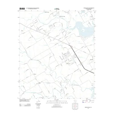
2012 Map of Speegleville
USGS Topo · Published 2012About this map
Waco Lake and the winding course of the N Bosque River dominate this Central Texas landscape west of Waco in 2012. The map reveals a suburban-rural mix where small communities like Willow Grove and Speegleville are positioned near the water's edge, while Highland and Windsor lie further south along the lower reaches of the Middle Bosque River. Small airfields, including Scott Airport and Wales Air Field, dot the terrain north of Ocee, suggesting the importance of private aviation in the region. Local history is anchored by sites like Evergreen Cem and McLennan Cem, as well as established crossings such as Caldwell Crossing and Eichelberger Crossing. The dense network of residential streets and rural routes, like Cedar Rock Pkwy and Baylor Camp Rd, reflects the steady expansion of settlements into the hills of Oak Rdg.
Find a feature on this map
123 named features on this map. Tap any name to fly to it.
Don’t see what you’re looking for? This feature index may not catch every label — zoom into the map to look around manually.
Map Details
Editions of this 2012 Speegleville Map
This is the sole edition of this map. No revisions or reprints were ever made.
Other maps of this area

1892 · Temple
USGS Topo · 1:125,000

1892 · Waco
USGS Topo · 1:125,000

1920 · Waco
USGS Topo · 1:125,000

1924 · Waco 4-c
USGS Topo · 1:48,000

1924 · Waco 3-d
USGS Topo · 1:48,000

1931 · Valley Mills
USGS Topo · 1:62,500

1931 · Elm Mott
USGS Topo · 1:62,500

1931 · Mc Gregor
USGS Topo · 1:62,500

1954 · Waco
USGS Topo · 1:250,000

1955 · Waco
USGS Topo · 1:250,000