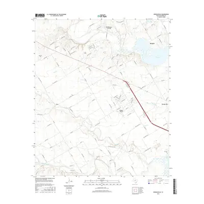
2016 Map of Speegleville
USGS Topo · Published 2016About this map
The confluence of the North Bosque River and Middle Bosque River defines this region of McLennan County, where the waterways feed into the expansive Waco Lake. This 2016 survey illustrates the modern suburban and rural landscape west of Waco, showing the growth of communities like Willow Grove and Speegleville. The terrain is marked by numerous small tributaries such as Schoolhouse Br, Tennant Br, and Hog Creek, which carve through the land toward the central reservoir. Aviation interests are represented by the presence of Wales Air Field and Scott Airport, while local history and genealogy are preserved through documented sites like Evergreen Cem and McLennan Cem. The map provides a detailed look at the transition from the denser street networks near the lake to the broader ranching and residential tracts at Eichelberger Crossing and the settlement of Ocee.
Find a feature on this map
107 named features on this map. Tap any name to fly to it.
Don’t see what you’re looking for? This feature index may not catch every label — zoom into the map to look around manually.
Map Details
Editions of this 2016 Speegleville Map
This is the sole edition of this map. No revisions or reprints were ever made.
Other maps of this area

1892 · Temple
USGS Topo · 1:125,000

1892 · Waco
USGS Topo · 1:125,000

1920 · Waco
USGS Topo · 1:125,000

1924 · Waco 4-c
USGS Topo · 1:48,000

1924 · Waco 3-d
USGS Topo · 1:48,000

1931 · Valley Mills
USGS Topo · 1:62,500

1931 · Elm Mott
USGS Topo · 1:62,500

1931 · Mc Gregor
USGS Topo · 1:62,500

1954 · Waco
USGS Topo · 1:250,000

1955 · Waco
USGS Topo · 1:250,000