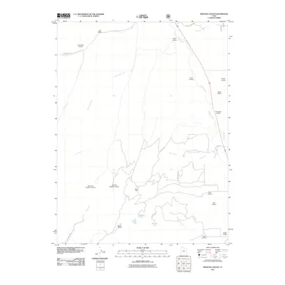
2011 Map of Spencer Canyon
USGS Topo · Published 2011About this map
Nebo Creek and Thistle Creek define the drainage patterns of this high mountain landscape in Utah County. The terrain is characterized by a complex network of canyons and hollows, including Gods Rock Hollow, Wash Canyon, and Losty Canyon, which channel seasonal runoff from the surrounding peaks. Toward the south, the topography rises toward Mount Baldy, where several small alpine water bodies like Madsen Lake, Blind Lake, and Hartney Lake are found near the Mud Flat region.
Find a feature on this map
30 named features on this map. Tap any name to fly to it.
Don’t see what you’re looking for? This feature index may not catch every label — zoom into the map to look around manually.
Map Details
Editions of this 2011 Spencer Canyon Map
This is the sole edition of this map. No revisions or reprints were ever made.
Other maps of this area

1885 · Manti
USGS Topo · 1:250,000

1895 · Manti
USGS Topo · 1:250,000

1951 · Moroni
USGS Topo · 1:62,500

1952 · Santaquin Peak
USGS Topo · 1:62,500

1956 · Price
USGS Topo · 1:250,000

1960 · Price
USGS Topo · 1:250,000

1962 · Price
USGS Topo · 1:250,000
1967 · Indianola
USGS Topo · 1:24,000
1967 · Thistle
USGS Topo · 1:24,000
1967 · Fairview
USGS Topo · 1:24,000