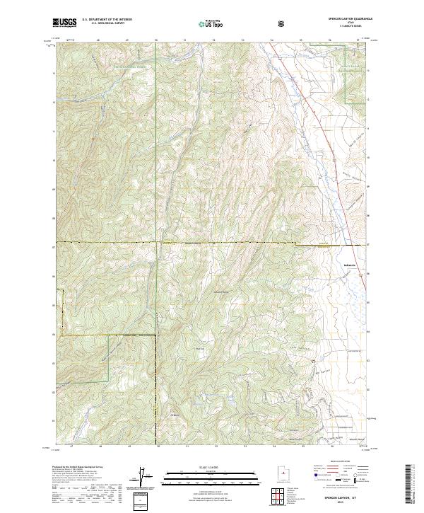
2023 Map of Spencer Canyon
USGS Topo · Published 2023About this map
Indianola sits at the eastern edge of this high-elevation landscape where the Wasatch Range meets the boundaries of the Uinta National Forest and Manti-La Sal National Forest. The map reveals a complex network of canyons and ridges, including the deep cuts of Spencer Canyon and Losty Canyon that drain toward the Thistle Creek corridor. To the south, a cluster of high-country water bodies including Madsen Lake, Hartney Lake, and Blind Lake sit tucked below Mt Baldy and the Hop Creek Ridge. The modern development pattern is most visible near the Sanpete County line, where a grid of residential roads like Tomahawk Dr and Thunder Cloud Cir contrasts with the surrounding wilderness and the traditional drainage systems of Birch Creek and Lake Canyon.
Find a feature on this map
55 named features on this map. Tap any name to fly to it.
Don’t see what you’re looking for? This feature index may not catch every label — zoom into the map to look around manually.
Map Details
Editions of this 2023 Spencer Canyon Map
This is the sole edition of this map. No revisions or reprints were ever made.
Other maps of this area

1885 · Manti
USGS Topo · 1:250,000

1895 · Manti
USGS Topo · 1:250,000

1951 · Moroni
USGS Topo · 1:62,500

1952 · Santaquin Peak
USGS Topo · 1:62,500

1956 · Price
USGS Topo · 1:250,000

1960 · Price
USGS Topo · 1:250,000

1962 · Price
USGS Topo · 1:250,000
1967 · Indianola
USGS Topo · 1:24,000
1967 · Thistle
USGS Topo · 1:24,000
1967 · Fairview
USGS Topo · 1:24,000