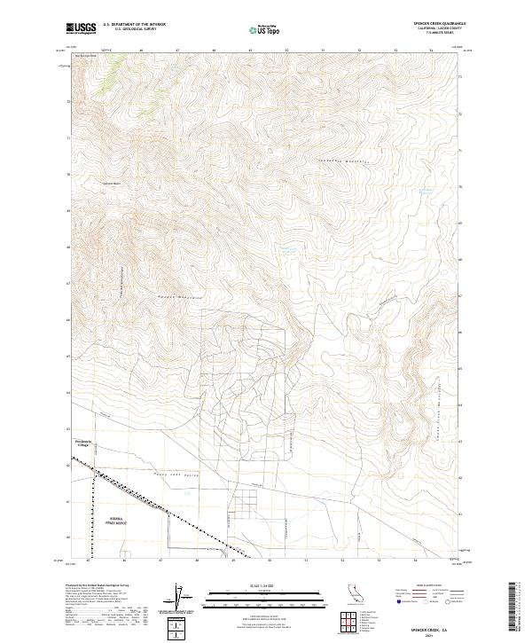
2021 Map of Spencer Creek
USGS Topo · Published 2021About this map
Honey Lake Valley anchors the southern portion of this Lassen County landscape, where the transition from high desert basin to mountain range is clearly defined. The small settlement of Peninsula Village sits along the western edge, connected by a network of local roads including Wendel Rd and Magazine Rd. To the north, the terrain rises sharply into the Skedaddle Mountains and Amedee Mountains, revealing a landscape carved by Thousand Spring Canyon and characterized by high elevations such as Hot Springs Peak. This survey provides a precise look at the arid hydrology of the region, documenting vital water sources like Little Cottonwood Spring, East Side Reservoir, and South Fork Reservoir within the high-altitude Spencer Basin. The eastern border is framed by the Smoke Creek Mountains, highlighting the complex topography that defines this section of northeastern California.
Find a feature on this map
23 named features on this map. Tap any name to fly to it.
Don’t see what you’re looking for? This feature index may not catch every label — zoom into the map to look around manually.
Map Details
Editions of this 2021 Spencer Creek Map
This is the sole edition of this map. No revisions or reprints were ever made.
Other maps of this area

1886 · Honey Lake
USGS Topo · 1:250,000

1886 · Granite Range
USGS Topo · 1:250,000

1891 · Honey Lake
USGS Topo · 1:250,000

1893 · Honey Lake
USGS Topo · 1:250,000

1894 · Granite Range
USGS Topo · 1:250,000

1954 · Wendel
USGS Topo · 1:62,500

1954 · Doyle
USGS Topo · 1:62,500

1955 · Westwood
USGS Topo · 1:250,000

1955 · Lovelock
USGS Topo · 1:250,000

1958 · Westwood
USGS Topo · 1:250,000