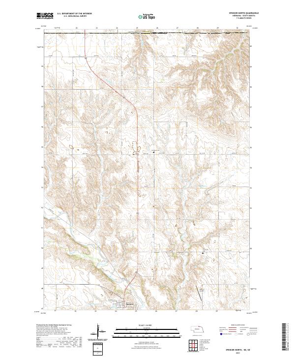
2021 Map of Spencer North
USGS Topo · Published 2021About this map
Spencer anchors the southern edge of this Boyd County landscape, situated where the terrain drops toward the banks of Ponca Creek. The northern reaches of the quadrangle cross the state line into South Dakota's Gregory County, following a topography defined by the drainage networks of Randall Cr and Beaver Cr. This 2021 survey reveals a rural infrastructure of section-line roads like Gross Rd and Oil Co Rd that connect isolated landmarks of community history, including Immanuel Cem and Old Immanuel Cem. The area's water management is evident in the presence of Blitzkie Reservoir and Klasna Reservoir, which provide essential storage in a region dominated by agricultural tracts and creek valleys. Further east, Huffy's Airport provides a small aviation waypoint amidst the rolling drainage basins of Spring Cr and Crooked Cr.
Find a feature on this map
43 named features on this map. Tap any name to fly to it.
Don’t see what you’re looking for? This feature index may not catch every label — zoom into the map to look around manually.
Map Details
Editions of this 2021 Spencer North Map
This is the sole edition of this map. No revisions or reprints were ever made.
Other maps of this area

1951 · Bristow
USGS Topo · 1:24,000

1952 · Spencer South
USGS Topo · 1:24,000

1952 · Butte SE
USGS Topo · 1:24,000

1955 · Mitchell
USGS Topo · 1:250,000

1955 · O'Neill
USGS Topo · 1:250,000

1959 · O'Neill
USGS Topo · 1:250,000

1959 · Mitchell
USGS Topo · 1:250,000

1964 · Butte
USGS Topo · 1:24,000

1964 · Fort Randall Dam
USGS Topo · 1:24,000

1964 · Gross
USGS Topo · 1:24,000