2022 Map of Spencer
USGS Topo · Published 2022About this map
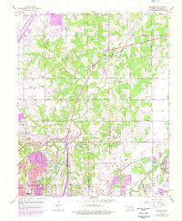
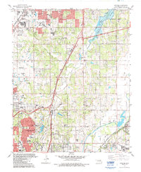
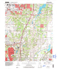
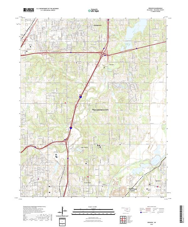
Oklahoma Christian University serves as a prominent landmark in the north, anchoring a landscape where the urban expansion of Oklahoma City and Edmond meets the winding course of the Deep Fork river. This 2022 survey captures the modern interface of suburban development and established memorial sites, including the expansive Memorial Park Cem and the Temple B'Nai Israel Cem. The terrain is marked by significant water features such as Lake Aluma and Massey Lake, while the southeastern corner is defined by the North Canadian River near the community of Spencer. Local history and genealogy researchers will find a dense concentration of burial grounds, from the Oklahoma Veterans Cem to smaller sites like Wright's Cem and Kolb Cem, reflecting the area's long-standing role as a place of rest and remembrance for the surrounding metropolitan region.
Find a feature on this map
76 named features on this map. Tap any name to fly to it.
Don’t see what you’re looking for? This feature index may not catch every label — zoom into the map to look around manually.
Map Details
Editions of this 2022 Spencer Map
This is the sole edition of this map. No revisions or reprints were ever made.
Historical Maps of Forest Park Through Time
5 maps found