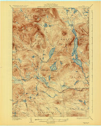
1932 Map of Spencer
USGS Topo · Published 1932About this map
Spencer Lake dominates the central basin of this Somerset County wilderness, serving as a focal point for early twentieth-century seasonal activity. To the north, Spencer Lake Camps Gerard PO indicates the establishment of remote postal services and sporting camps, while King and Bartlett Camps sit nestled near King and Bartlett Lake. The landscape is defined by the high peaks of the Spencer Mountains, including Tumbledown Mtn and Spotted Spruce Mtn. The hydrology is complex, with Spencer Stream winding through the terrain past Gore Rapids and Spencer Gut. Traces of the regional timber industry appear near the southern reaches at the Augusta Lumber Co Camp, illustrating the commercial interests that utilized these waterways and forests long before modern development altered the character of the Maine woods.
Find a feature on this map
81 named features on this map. Tap any name to fly to it.
Don’t see what you’re looking for? This feature index may not catch every label — zoom into the map to look around manually.
Map Details
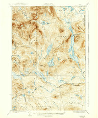
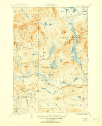
Editions of this 1932 Spencer Map
4 editions found

Other maps of this area

1922 · Long Pond
USGS Topo · 1:62,500

1923 · Attean
USGS Topo · 1:62,500

1924 · Long Pond
USGS Topo · 1:62,500

1925 · Pierce Pond
USGS Topo · 1:48,000

1925 · Attean
USGS Topo · 1:62,500

1927 · Pierce Pond
USGS Topo · 1:62,500

1928 · Chain Lakes
USGS Topo · 1:48,000

1928 · Skinner
USGS Topo · 1:48,000

1928 · Spencer
USGS Topo · 1:48,000

1928 · Dead River
USGS Topo · 1:62,500
Featured Places
- Flagstaff Township, ME
- Upper Enchanted Township, ME
- Haynestown Township, ME
- Kibby Township, ME
- T3 R5 BKP WKR, ME