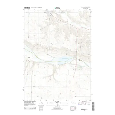
2014 Map of Spencer South
USGS Topo · Published 2014About this map
The town of Spencer serves as the primary hub in this portion of Boyd County, where the plains meet the water systems of northern Nebraska. For genealogists and local researchers, several burial grounds provide important links to the area's early families, including Bohemian Cem, Saint Marys Cem, and Union Cem. The landscape is defined by the proximity of the Niobrara River valley and several smaller water features like Klasna Reservoir. Near the western edge of the map, the small settlement of Anncar marks a distinct point of historical interest along the county line. The road network and drainage patterns shown here reflect the agricultural foundation and rural structure of the region in the early twenty-first century.
Find a feature on this map
6 named features on this map. Tap any name to fly to it.
Don’t see what you’re looking for? This feature index may not catch every label — zoom into the map to look around manually.
Map Details
Editions of this 2014 Spencer South Map
This is the sole edition of this map. No revisions or reprints were ever made.
Other maps of this area

1951 · Bristow
USGS Topo · 1:24,000

1952 · Spencer South
USGS Topo · 1:24,000

1952 · Butte SE
USGS Topo · 1:24,000

1954 · Meek NE
USGS Topo · 1:24,000

1954 · Meek
USGS Topo · 1:24,000

1954 · Atkinson NE
USGS Topo · 1:24,000

1955 · O'Neill
USGS Topo · 1:250,000

1959 · O'Neill
USGS Topo · 1:250,000

1964 · Butte
USGS Topo · 1:24,000

1964 · Gross
USGS Topo · 1:24,000