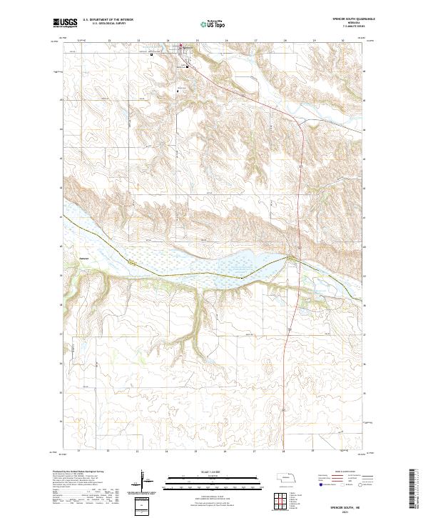
2021 Map of Spencer South
USGS Topo · Published 2021About this map
Spencer stands at the northern edge of this Nebraska landscape, where the rolling uplands of Boyd County meet the drainage of the Niobrara River. The map reveals a community deeply rooted in its heritage, marked by the presence of the Bohemian Cem, Saint Marys Cem, and Union Cem situated along the plateaus above the river valley. The central corridor is dominated by the wide, braided path of the river, which serves as the county boundary and is harnessed by the Northern Nebraska Plant Reservoir Number 1.
Find a feature on this map
34 named features on this map. Tap any name to fly to it.
Don’t see what you’re looking for? This feature index may not catch every label — zoom into the map to look around manually.
Map Details
Editions of this 2021 Spencer South Map
This is the sole edition of this map. No revisions or reprints were ever made.
Other maps of this area

1951 · Bristow
USGS Topo · 1:24,000

1952 · Spencer South
USGS Topo · 1:24,000

1952 · Butte SE
USGS Topo · 1:24,000

1954 · Meek NE
USGS Topo · 1:24,000

1954 · Meek
USGS Topo · 1:24,000

1954 · Atkinson NE
USGS Topo · 1:24,000

1955 · O'Neill
USGS Topo · 1:250,000

1959 · O'Neill
USGS Topo · 1:250,000

1964 · Butte
USGS Topo · 1:24,000

1964 · Gross
USGS Topo · 1:24,000