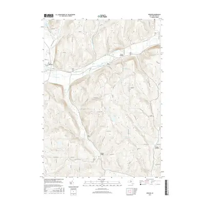
2016 Map of Spencer
USGS Topo · Published 2016About this map
Spencer stands at a topographic crossroads in Tioga County, where Catatonk Creek meets the headwaters of Nichols Pond and Seelytown Cr. This survey captures a landscape defined by deeply incised valleys and upland ridges, reflecting a settlement pattern tied to the drainage of the South Branch Catatonk Creek and S Br Catatonk Cr. The area is notably dense with small, family or community burial grounds, such as the Ferris Cem and Schumacher Road Cem, which are scattered among the high ridges of Evelin Hill and the valley floors. Small hamlets like Halsey Valley, West Candor, and Straits Corners serve as local hubs for a network of hill roads including Gay Hollow Rd and Tallow Hill Rd. Numerous water features, from the natural expanse of Spencer Lake to the smaller Empire Lake and Lake Diana, illustrate the complex hydrology that historically supported the region's agricultural and milling operations.
Find a feature on this map
86 named features on this map. Tap any name to fly to it.
Don’t see what you’re looking for? This feature index may not catch every label — zoom into the map to look around manually.
Map Details
Editions of this 2016 Spencer Map
This is the sole edition of this map. No revisions or reprints were ever made.
Other maps of this area

1893 · Ithaca
USGS Topo · 1:62,500

1895 · Ithaca
USGS Topo · 1:62,500

1900 · Dryden
USGS Topo · 1:62,500

1902 · Waverly
USGS Topo · 1:62,500

1903 · Owego
USGS Topo · 1:62,500

1905 · Watkins Glen
USGS Topo · 1:125,000

1906 · Catatonk
USGS Topo · 1:125,000

1949 · Willseyville
USGS Topo · 1:24,000

1949 · Speedsville
USGS Topo · 1:24,000

1950 · Elmira
USGS Topo · 1:250,000