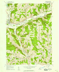
1956 Map of Spencer
USGS Topo · Published 1958About this map
Spencer and its neighboring hamlets serve as the focal point for this mid-century topographic survey of the Tioga County uplands. The landscape is defined by the winding course of Catatonk Creek and the South Branch, which carved deep valleys through prominent elevations like Tallow Hill and Dawson Hill. These valleys became the primary corridors for early transportation, illustrated by the Lehigh Valley railroad and arterial roads that connect Baptist Corners to the village center.
Find a feature on this map
55 named features on this map. Tap any name to fly to it.
Don’t see what you’re looking for? This feature index may not catch every label — zoom into the map to look around manually.
Map Details
Editions of this 1956 Spencer Map
This is the sole edition of this map. No revisions or reprints were ever made.
Other maps of this area

1893 · Ithaca
USGS Topo · 1:62,500

1895 · Ithaca
USGS Topo · 1:62,500

1900 · Dryden
USGS Topo · 1:62,500

1902 · Waverly
USGS Topo · 1:62,500

1903 · Owego
USGS Topo · 1:62,500

1905 · Watkins Glen
USGS Topo · 1:125,000

1906 · Catatonk
USGS Topo · 1:125,000

1949 · Willseyville
USGS Topo · 1:24,000

1949 · Speedsville
USGS Topo · 1:24,000

1950 · Elmira
USGS Topo · 1:250,000