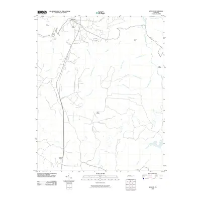
2010 Map of Spencer
USGS Topo · Published 2010About this map
Spencer serves as the focal point of this 2010 survey, perched atop the plateau where the residential streets transition into the winding rural routes of Van Buren County. The landscape is defined by the sharp descent of the Van Buren Bluffs and the deeply carved drainage systems of Cane Creek and Piney Creek. This era of the landscape is marked by both its natural landmarks, such as Piney Creek Falls and Haston Point, and its industrial footprint, notably the Rigby Number One Mine located south of the main settlement. Genealogy researchers will find several family burial grounds across the area, including Hale Cemetery and Denney Cemetery near the town center, and the more remote Shockley Cemetery and Miller Cemetery to the south. The road network, featuring names like Golden Point Rd and Feedstore Rd, reveals the agricultural and residential patterns of the early 21st century before modern developments altered these traditional corridors.
Find a feature on this map
52 named features on this map. Tap any name to fly to it.
Don’t see what you’re looking for? This feature index may not catch every label — zoom into the map to look around manually.
Map Details
Editions of this 2010 Spencer Map
This is the sole edition of this map. No revisions or reprints were ever made.
Other maps of this area

1892 · Pikeville
USGS Topo · 1:125,000

1893 · Mc Minnville
USGS Topo · 1:125,000

1895 · Mc Minnville
USGS Topo · 1:125,000

1895 · Pikeville
USGS Topo · 1:125,000

1935 · Brockdell
USGS Topo · 1:24,000

1935 · Smart Mountain
USGS Topo · 1:24,000

1943 · Cookeville
USGS Topo · 1:100,000

1944 · Cookeville
USGS Topo · 1:100,000
1946 · Smartt Mountain
USGS Topo · 1:24,000
1946 · Brockdell
USGS Topo · 1:24,000