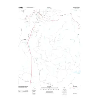
2013 Map of Spencer
USGS Topo · Published 2013About this map
Spencer serves as the focal point of this Van Buren County landscape, where the plateau terrain is defined by a complex network of drainage and steep elevation changes. The settlement pattern follows the high ground along routes like Old Hwy 30 and Spencer Dr, while the surrounding territory is marked by dramatic geological features such as Lost Cove, Lick Cove, and Molloy Hollow. To the southeast, the geography transitions toward the water-rich environment of Fall Creek Falls Lake and the significant drop of Piney Creek Falls.
Find a feature on this map
82 named features on this map. Tap any name to fly to it.
Don’t see what you’re looking for? This feature index may not catch every label — zoom into the map to look around manually.
Map Details
Editions of this 2013 Spencer Map
This is the sole edition of this map. No revisions or reprints were ever made.
Other maps of this area

1892 · Pikeville
USGS Topo · 1:125,000

1893 · Mc Minnville
USGS Topo · 1:125,000

1895 · Mc Minnville
USGS Topo · 1:125,000

1895 · Pikeville
USGS Topo · 1:125,000

1935 · Brockdell
USGS Topo · 1:24,000

1935 · Smart Mountain
USGS Topo · 1:24,000

1943 · Cookeville
USGS Topo · 1:100,000

1944 · Cookeville
USGS Topo · 1:100,000
1946 · Smartt Mountain
USGS Topo · 1:24,000
1946 · Brockdell
USGS Topo · 1:24,000