
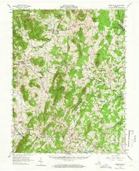
1961 Map of Sperryville
USGS Topo · Published 1962About this map
Shenandoah National Park and the eastern slopes of the Blue Ridge dominate this 1961 topographic survey, revealing a landscape defined by its numerous small mountain peaks and river valleys. The town of Washington serves as a focal point in the north, while Sperryville sits at the base of the mountains to the west. The area is characterized by a high density of small, family-centric landmarks, including dozens of scattered cemeteries and community churches such as Hope Hill Chapel, New Salem Ch, and Old School Ch.
Find a feature on this map
113 named features on this map. Tap any name to fly to it.
Don’t see what you’re looking for? This feature index may not catch every label — zoom into the map to look around manually.
Map Details
Editions of this 1961 Sperryville Map
2 editions found
Other maps of this area

1887 · Spottsylvania
USGS Topo · 1:125,000

1892 · Spottsylvania
USGS Topo · 1:125,000

1892 · Gordonsville
USGS Topo · 1:125,000

1893 · Luray
USGS Topo · 1:125,000

1894 · Warrenton
USGS Topo · 1:125,000

1894 · Warrenton
USGS Topo · 1:62,500

1905 · Luray
USGS Topo · 1:125,000

1927 · Remington
USGS Topo · 1:48,000

1929 · Stony Man
USGS Topo · 1:48,000

1930 · Warrenton
USGS Topo · 1:62,500