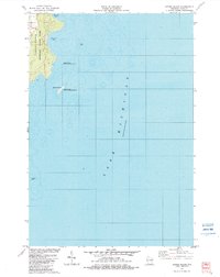
1982 Map of Spider Island
USGS Topo · Published 1983About this map
Newport State Park dominates the rugged shoreline of the Door Peninsula in this early 1980s coastal study, preserving a significant stretch of woodland and sandy coastline within the town of Liberty Grove. The map details the transition from land to the deep waters of Lake Michigan, highlighting the dangerous shoals and small islands that define this maritime environment. Just offshore, Spider Island and the Gravel Island National Wildlife Refuge provide protected habitats for local bird populations. Inlets such as Europe Bay and Newport Bay break the rocky coast, while a small inland Gravel Pit indicates the local extraction of materials for road building or construction. The bathymetric data reveals a complex underwater topography, including Outer Shoal and Four Foot Shoal, which historically challenged navigation along this stretch of the Great Lakes.
Find a feature on this map
10 named features on this map. Tap any name to fly to it.
Don’t see what you’re looking for? This feature index may not catch every label — zoom into the map to look around manually.
Map Details
Editions of this 1982 Spider Island Map
2 editions found
Other maps of this area

1954 · Escanaba
USGS Topo · 1:250,000

1957 · Escanaba
USGS Topo · 1:250,000

1958 · Escanaba
USGS Topo · 1:250,000

1960 · Washington Island
USGS Topo · 1:62,500

1960 · Sister Bay
USGS Topo · 1:62,500

1960 · Ellison Bay
USGS Topo · 1:62,500

1981 · Marinette
USGS Topo · 1:100,000

1982 · Washington Island SE
USGS Topo · 1:24,000
1982 · Ellison Bay
USGS Topo · 1:24,000
1982 · Baileys Harbor East
USGS Topo · 1:24,000