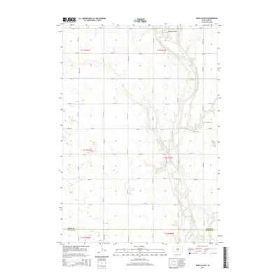
2015 Map of Spink Colony
USGS Topo · Published 2015About this map
The James River snakes through the eastern half of this prairie landscape, creating a distinct riparian corridor against the grid of section lines in Spink County. Established on the high ground near the river's bend, the Spink Colony is a primary focal point, reflecting the unique communal settlement patterns of the Hutterite tradition in South Dakota. The terrain is dotted with small depressions and wetlands, notably Lake Dudley, which sits west of the river's main channel. Along the eastern edge, the Hillestad Cem serves as a localized landmark for genealogical research. The southern margin of the map is defined by the boundary between Spink Co and Beadle Co, illustrating the transition into the neighboring township. This 2015 survey documents the enduring agricultural layout of the region, where the section roads such as 182nd St and 396th Ave provide a rigid framework for the rural homesteads and communal lands.
Find a feature on this map
26 named features on this map. Tap any name to fly to it.
Don’t see what you’re looking for? This feature index may not catch every label — zoom into the map to look around manually.
Map Details
Editions of this 2015 Spink Colony Map
This is the sole edition of this map. No revisions or reprints were ever made.
Other maps of this area

1895 · Byron
USGS Topo · 1:125,000

1953 · Huron
USGS Topo · 1:250,000

1954 · Huron
USGS Topo · 1:250,000

1956 · Lake Byron NW
USGS Topo · 1:24,000

1956 · Glendale Colony
USGS Topo · 1:24,000

1956 · Lake Byron
USGS Topo · 1:24,000

1956 · Spink Colony
USGS Topo · 1:24,000

1956 · Doland SW
USGS Topo · 1:24,000

1956 · Hitchcock SE
USGS Topo · 1:24,000

1967 · Frankfort SW
USGS Topo · 1:24,000
Featured Places
- Spink Hutterite Colony, SD
- Belmont Township, SD
- Lincoln Township, SD
- Cornwall Township, SD
- Crandon Township, SD