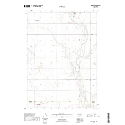
2017 Map of Spink Colony
USGS Topo · Published 2017About this map
James River meanders across this eastern South Dakota landscape, defining the topography of the glacial till plains. In the northern reaches of the quadrangle, the Spink Colony is established near the river banks, accompanied by the Spink Colony Cem. The area exhibits a classic township and range grid, where rural roads like 397th Ave and Co Rd 26 intersect a terrain dotted with numerous small wetlands and depressions typical of the region's prairie pothole geology. Further south, Lake Dudley sits in a widened reach of the river valley, while the Hillestad Cem serves as a lone landmark on the higher ground of the eastern sections. The map also records the jurisdictional boundary where Spink Co meets Beadle Co, illustrating the organized agricultural layout of the early 21st century.
Find a feature on this map
28 named features on this map. Tap any name to fly to it.
Don’t see what you’re looking for? This feature index may not catch every label — zoom into the map to look around manually.
Map Details
Editions of this 2017 Spink Colony Map
This is the sole edition of this map. No revisions or reprints were ever made.
Other maps of this area

1895 · Byron
USGS Topo · 1:125,000

1953 · Huron
USGS Topo · 1:250,000

1954 · Huron
USGS Topo · 1:250,000

1956 · Lake Byron NW
USGS Topo · 1:24,000

1956 · Glendale Colony
USGS Topo · 1:24,000

1956 · Lake Byron
USGS Topo · 1:24,000

1956 · Spink Colony
USGS Topo · 1:24,000

1956 · Doland SW
USGS Topo · 1:24,000

1956 · Hitchcock SE
USGS Topo · 1:24,000

1967 · Frankfort SW
USGS Topo · 1:24,000
Featured Places
- Spink Hutterite Colony, SD
- Belmont Township, SD
- Lincoln Township, SD
- Cornwall Township, SD
- Crandon Township, SD