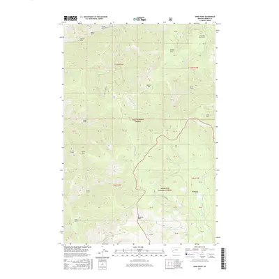
2017 Map of Spink Point
USGS Topo · Published 2017About this map
John Long Mountains define the high terrain of this portion of Granite County, where the borders of Lolo National Forest and Deerlodge National Forest converge. The landscape is characterized by a dense network of drainages and named gulches, including Golden Gulch and Mason Gulch in the north, and Chico Gulch in the south. These features suggest a history of prospecting and drainage-based navigation through the timbered slopes. High points such as Sliderock Mtn, Spink Point, and the prominent Sandstone Ridge provide significant landmarks across the quadrangle. Human activity is evidenced by the passage of Co Rd 354 and Brewster Creek Rd, which follow the natural contours of the land, while Mountain Spring serves as a vital water source in the heart of the forest.
Find a feature on this map
52 named features on this map. Tap any name to fly to it.
Don’t see what you’re looking for? This feature index may not catch every label — zoom into the map to look around manually.
Map Details
Editions of this 2017 Spink Point Map
This is the sole edition of this map. No revisions or reprints were ever made.
Other maps of this area

1903 · Bonner
USGS Topo · 1:125,000

1908 · Philipsburg
USGS Topo · 1:125,000

1909 · Sapphire
USGS Topo · 1:125,000

1919 · Drummond
USGS Topo · 1:125,000

1921 · Drummond
USGS Topo · 1:125,000

1947 · Butte
USGS Topo · 1:250,000

1958 · Butte
USGS Topo · 1:250,000

1959 · Bearmouth
USGS Topo · 1:62,500

1959 · Ravenna
USGS Topo · 1:62,500

1960 · Butte
USGS Topo · 1:250,000