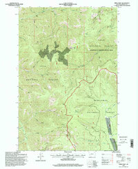
1996 Map of Spink Point
USGS Topo · Published 1998About this map
Brewster Mine and Edelman Mine mark the northern reaches of this high-elevation Montana landscape, where mining operations were concentrated along the drainages of North Fork Brewster Creek. The terrain is defined by the intersection of the Lolo National Forest and the Deerlodge National Forest, a region characterized by significant mineral exploration as evidenced by numerous adits and prospects scattered across the slopes. To the south, the Sandstone Trail follows the spine of Sandstone Ridge, providing access through a rugged interior punctuated by summits like Sliderock Mountain, which features the Side Rock Lookout. The hydrological network is dense, with many smaller streams like Grizzly Creek and Flat Creek feeding into larger systems such as Upper Willow Creek, illustrating the complex drainage patterns of the Flint Creek Range.
Find a feature on this map
46 named features on this map. Tap any name to fly to it.
Don’t see what you’re looking for? This feature index may not catch every label — zoom into the map to look around manually.
Map Details
Editions of this 1996 Spink Point Map
This is the sole edition of this map. No revisions or reprints were ever made.
Other maps of this area

1903 · Bonner
USGS Topo · 1:125,000

1908 · Philipsburg
USGS Topo · 1:125,000

1909 · Sapphire
USGS Topo · 1:125,000

1919 · Drummond
USGS Topo · 1:125,000

1921 · Drummond
USGS Topo · 1:125,000

1947 · Butte
USGS Topo · 1:250,000

1958 · Butte
USGS Topo · 1:250,000

1959 · Bearmouth
USGS Topo · 1:62,500

1959 · Ravenna
USGS Topo · 1:62,500

1960 · Butte
USGS Topo · 1:250,000