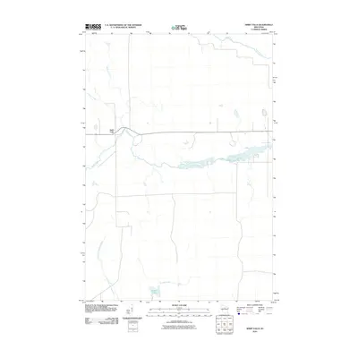
2010 Map of Spirit Falls
USGS Topo · Published 2010About this map
The settlement of Spirit Falls anchors this northern Wisconsin landscape, situated along the upper reaches of the Spirit River. This 2010 survey illustrates a region defined by its dense network of waterways, where the river widens into several elongated basins. To the south, the terrain drains toward Krueger Lake and Krueger Creek, while the southwestern corner is marked by the winding path of the East Fork New Wood River. The northern boundary of the quadrangle follows the Somo River, showing the intricate hydrography of Lincoln County before these waters move toward larger regional systems. The map depicts a predominantly rural and wooded area, with tributaries like Pappose Creek and Squaw Creek feeding into the primary river valleys, providing a clear record of the natural drainage and isolated road networks of the early 21st century.
Find a feature on this map
8 named features on this map. Tap any name to fly to it.
Don’t see what you’re looking for? This feature index may not catch every label — zoom into the map to look around manually.
Map Details
Editions of this 2010 Spirit Falls Map
This is the sole edition of this map. No revisions or reprints were ever made.
Other maps of this area

1939 · Mc Cord
USGS Topo · 1:48,000

1941 · Brantwood
USGS Topo · 1:48,000

1943 · Brantwood
USGS Topo · 1:48,000

1945 · Rib Lake
USGS Topo · 1:48,000

1947 · Mc Cord
USGS Topo · 1:48,000

1947 · Rib Lake
USGS Topo · 1:48,000

1949 · Rib Lake
USGS Topo · 1:48,000

1950 · Spirit Falls
USGS Topo · 1:48,000

1952 · Spirit Falls
USGS Topo · 1:48,000

1953 · Rice Lake
USGS Topo · 1:250,000