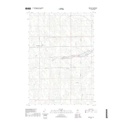
2018 Map of Spirit Falls
USGS Topo · Published 2018About this map
Spirit Falls sits at the heart of this Northwoods landscape, where the Somo River and Spirit River drainage basins converge. The terrain is defined by a dense network of tributaries including Popcorn Cr, Squaw Cr, and Krueger Cr, which feeds into the secluded Krueger Lake in the southern portion of the quadrangle. This 2018 survey illustrates a modern rural infrastructure of local roads like Phalgraff Rd and Wilson School Dr, alongside an extensive recreational system of the Snowmobile Trl crisscrossing the wooded sections. To the east, the E Fork North Wood River flows through the wetland-rich environment, reflecting the hydrologic complexity of Lincoln County. The map provides a clear record of contemporary land use, balancing small settlements with protected natural water systems.
Find a feature on this map
27 named features on this map. Tap any name to fly to it.
Don’t see what you’re looking for? This feature index may not catch every label — zoom into the map to look around manually.
Map Details
Editions of this 2018 Spirit Falls Map
This is the sole edition of this map. No revisions or reprints were ever made.
Other maps of this area

1939 · Mc Cord
USGS Topo · 1:48,000

1941 · Brantwood
USGS Topo · 1:48,000

1943 · Brantwood
USGS Topo · 1:48,000

1945 · Rib Lake
USGS Topo · 1:48,000

1947 · Mc Cord
USGS Topo · 1:48,000

1947 · Rib Lake
USGS Topo · 1:48,000

1949 · Rib Lake
USGS Topo · 1:48,000

1950 · Spirit Falls
USGS Topo · 1:48,000

1952 · Spirit Falls
USGS Topo · 1:48,000

1953 · Rice Lake
USGS Topo · 1:250,000