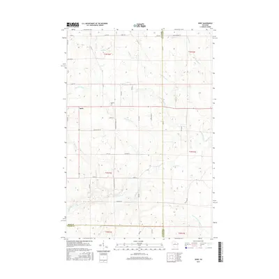
2015 Map of Spirit
USGS Topo · Published 2015About this map
Spirit anchors this north-central Wisconsin landscape where Price, Lincoln, and Taylor counties converge. The terrain is defined by a dense network of watercourses, including the Spirit River and its N Fork, as well as the Center Fork New Wood River. The local road system reflects the area's immigrant heritage and rural industry, evidenced by the intersection of N German Settlement Rd and S German Settlement Rd, as well as Cheese Factory Rd.
Find a feature on this map
51 named features on this map. Tap any name to fly to it.
Don’t see what you’re looking for? This feature index may not catch every label — zoom into the map to look around manually.
Map Details
Editions of this 2015 Spirit Map
This is the sole edition of this map. No revisions or reprints were ever made.
Other maps of this area

1939 · Mc Cord
USGS Topo · 1:48,000

1941 · Brantwood
USGS Topo · 1:48,000

1943 · Brantwood
USGS Topo · 1:48,000

1945 · Rib Lake
USGS Topo · 1:48,000

1947 · Mc Cord
USGS Topo · 1:48,000

1947 · Rib Lake
USGS Topo · 1:48,000

1949 · Rib Lake
USGS Topo · 1:48,000

1950 · Spirit Falls
USGS Topo · 1:48,000

1952 · Spirit Falls
USGS Topo · 1:48,000

1953 · Rice Lake
USGS Topo · 1:250,000