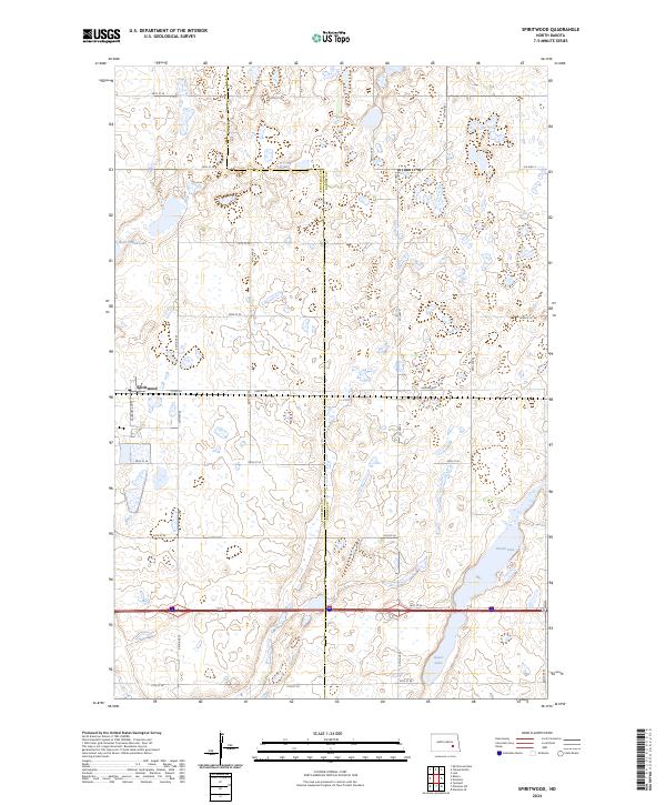
2024 Map of Spiritwood
USGS Topo · Published 2024About this map
Spiritwood sits along the western edge of this prairie landscape, which straddles the Stutsman Co Barnes Co line in central North Dakota. The area is characterized by a dense concentration of glacial potholes and wetlands, many of which are protected within the Stutsman County Waterfowl Production Area and the Barnes County Waterfowl Production Area. These conservation zones surround significant water bodies including Rush Island Lake, Island Lake, and Goose Lake, reflecting the region's importance for migratory bird habitat. The terrain is organized by a precise grid of section-line roads, such as Co RD 40 and 30th ST Se, which navigate the numerous depressions and rises typical of the prairie pothole region. This 2024 survey captures the persistence of small-scale agriculture alongside dedicated wildlife preservation efforts in the modern era.
Find a feature on this map
31 named features on this map. Tap any name to fly to it.
Don’t see what you’re looking for? This feature index may not catch every label — zoom into the map to look around manually.
Map Details
Editions of this 2024 Spiritwood Map
This is the sole edition of this map. No revisions or reprints were ever made.
Other maps of this area

1896 · Jamestown
USGS Topo · 1:125,000

1897 · Eckelson
USGS Topo · 1:125,000

1900 · Pingree
USGS Topo · 1:125,000

1951 · Spiritwood Lake
USGS Topo · 1:24,000

1952 · Ypsilanti
USGS Topo · 1:24,000

1952 · Bloom
USGS Topo · 1:24,000

1952 · New Rockford
USGS Topo · 1:250,000

1953 · Jamestown
USGS Topo · 1:250,000

1956 · New Rockford
USGS Topo · 1:250,000

1956 · Jamestown
USGS Topo · 1:250,000