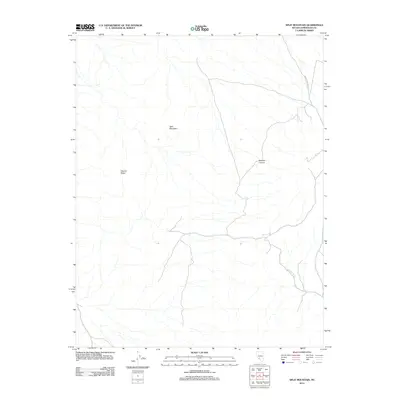
2012 Map of Split Mountain
USGS Topo · Published 2012About this map
Split Mountain dominates this portion of the Great Basin as recorded during a 2012 survey of the high desert terrain. The topography is defined by the sharp elevations of Clayton Ridge and the winding descent of Nevada Canyon, illustrating the complex drainage patterns of this arid landscape. This specific survey provides a snapshot of the region's minimal infrastructure in the early 21st century, where human presence is largely limited to unpaved routes like Montezuma Well Rd. The natural flow of water is traced through Jackson Wash, which serves as the primary hydrological feature in an area defined more by its landforms than by permanent settlements. The map highlights the isolation and physical structure of Esmeralda County, providing precise data on elevations and dry wash systems essential for understanding the local environment.
Find a feature on this map
5 named features on this map. Tap any name to fly to it.
Don’t see what you’re looking for? This feature index may not catch every label — zoom into the map to look around manually.
Map Details
Editions of this 2012 Split Mountain Map
This is the sole edition of this map. No revisions or reprints were ever made.
Other maps of this area

1898 · Silver Peak
USGS Topo · 1:125,000

1900 · Silver Peak
USGS Topo · 1:125,000

1908 · Lida
USGS Topo · 1:250,000

1913 · Lida
USGS Topo · 1:250,000

1945 · Goldfield
USGS Topo · 1:125,000

1954 · Goldfield
USGS Topo · 1:250,000

1955 · Goldfield
USGS Topo · 1:250,000

1958 · Goldfield
USGS Topo · 1:250,000

1962 · Goldfield
USGS Topo · 1:250,000

1963 · Silver Peak
USGS Topo · 1:62,500