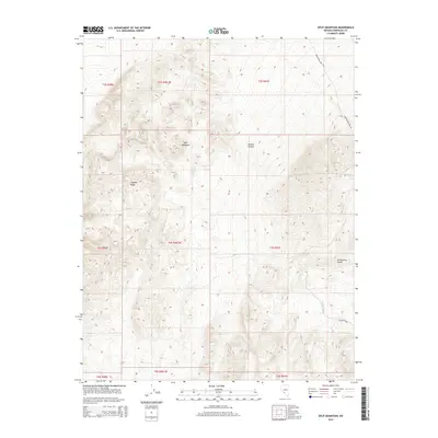
2014 Map of Split Mountain
USGS Topo · Published 2014About this map
Split Mountain dominates the central portion of this 2014 survey, which covers a section of the Nevada high desert within Esmeralda County. The landscape is defined by the elevation changes between the Montezuma Range to the southeast and Clayton Ridge to the west. Evidence of human presence is concentrated in primitive routes such as Montezuma Well Rd and the drainage-hugging Jackson Wash, indicating a reliance on natural topographies for transit. The map provides a detailed view of the Public Land Survey System divisions, documenting Township and Range boundaries like t3s r40.5e and t2s r41e, which are essential for property researchers and geologists studying the intricate land-claim patterns of this arid region. The drainage patterns around Nevada Canyon further illustrate the hydrology of these desert ranges.
Find a feature on this map
16 named features on this map. Tap any name to fly to it.
Don’t see what you’re looking for? This feature index may not catch every label — zoom into the map to look around manually.
Map Details
Editions of this 2014 Split Mountain Map
This is the sole edition of this map. No revisions or reprints were ever made.
Other maps of this area

1898 · Silver Peak
USGS Topo · 1:125,000

1900 · Silver Peak
USGS Topo · 1:125,000

1908 · Lida
USGS Topo · 1:250,000

1913 · Lida
USGS Topo · 1:250,000

1945 · Goldfield
USGS Topo · 1:125,000

1954 · Goldfield
USGS Topo · 1:250,000

1955 · Goldfield
USGS Topo · 1:250,000

1958 · Goldfield
USGS Topo · 1:250,000

1962 · Goldfield
USGS Topo · 1:250,000

1963 · Silver Peak
USGS Topo · 1:62,500