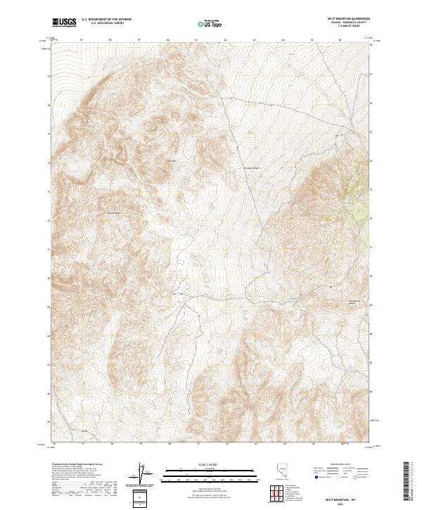
2021 Map of Split Mountain
USGS Topo · Published 2021About this map
Split Mtn stands as the central landmark in this high-desert region of Esmeralda County, where the terrain is defined by dramatic ridgelines and dry drainage systems. The Clayton Ridge dominates the western portion of the map, while the eastern edge is marked by the rugged slopes of the Montezuma Range. This 2021 survey reveals a landscape largely shaped by natural contours rather than dense human settlement, typical of the Great Basin's basin-and-range topography. Water management and drainage are evidenced by features like Nevada Canyon and the seasonal Jackson Wash in the southeast. The map provides precise Public Land Survey System data across various townships, including t3s r40.5e, illustrating how this remote Nevada interior is gridded for administration and land management.
Find a feature on this map
14 named features on this map. Tap any name to fly to it.
Don’t see what you’re looking for? This feature index may not catch every label — zoom into the map to look around manually.
Map Details
Editions of this 2021 Split Mountain Map
This is the sole edition of this map. No revisions or reprints were ever made.
Other maps of this area

1898 · Silver Peak
USGS Topo · 1:125,000

1900 · Silver Peak
USGS Topo · 1:125,000

1908 · Lida
USGS Topo · 1:250,000

1913 · Lida
USGS Topo · 1:250,000

1945 · Goldfield
USGS Topo · 1:125,000

1954 · Goldfield
USGS Topo · 1:250,000

1955 · Goldfield
USGS Topo · 1:250,000

1958 · Goldfield
USGS Topo · 1:250,000

1962 · Goldfield
USGS Topo · 1:250,000

1963 · Silver Peak
USGS Topo · 1:62,500