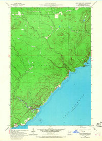
1956 Map of Split Rock Point
USGS Topo · Published 1968About this map
Lake Superior’s North Shore exhibits its characteristic rocky geology and drainage patterns in the mid-1950s, defined by the sharp transition from the highland plateaus to the water's edge. The landscape is dominated by the cascading waters of Gooseberry Falls and the surrounding Gooseberry Falls State Park, where the Gooseberry River meets the lake. Evidence of the region’s earlier logging or industrial period remains visible through the Old Railroad Grade that winds parallel to the coastline near Castle Danger.
Find a feature on this map
20 named features on this map. Tap any name to fly to it.
Don’t see what you’re looking for? This feature index may not catch every label — zoom into the map to look around manually.
Map Details
Editions of this 1956 Split Rock Point Map
3 editions found
Other maps of this area

1953 · Whyte
USGS Topo · 1:62,500

1954 · Silver Bay
USGS Topo · 1:62,500

1954 · Two Harbors
USGS Topo · 1:250,000

1956 · Split Rock Point
USGS Topo · 1:24,000

1956 · Split Rock Point
USGS Topo · 1:62,500

1956 · Split Rock Point NE
USGS Topo · 1:24,000

1957 · Two Harbors
USGS Topo · 1:250,000

1957 · Two Harbors
USGS Topo · 1:62,500

1957 · Two Harbors NE
USGS Topo · 1:24,000

1957 · Castle Danger
USGS Topo · 1:24,000