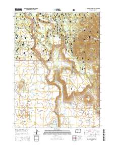
2014 Map of Spodue Mountain
USGS Topo · Published 2014About this map
Spodue Mountain serves as a prominent landmark in this transition zone between the Winema National Forest and Fremont National Forest during the mid-2010s. The landscape is defined by the winding course of the Sycan River and a scattering of family-named water sources and landforms. High-elevation flats like Cordelia Flat and Elde Flat sit above the Coyote Bucket canyon, illustrating the volcanic and tectonic topography of the Oregon Cascades. The network of Forest Service roads, including Nat For Dev Rd 3462 and Nat For Dev Rd 347, provides access to remote features such as Rose Mary Pond and Wild Billy Lake. For those interested in the area's pioneer history, labels like Tim Brown Spring and Bob Plant Spring suggest early grazing or homesteading footprints in the high country.
Find a feature on this map
44 named features on this map. Tap any name to fly to it.
Don’t see what you’re looking for? This feature index may not catch every label — zoom into the map to look around manually.
Map Details
Editions of this 2014 Spodue Mountain Map
This is the sole edition of this map. No revisions or reprints were ever made.
Other maps of this area

1889 · Klamath
USGS Topo · 1:250,000

1894 · Klamath
USGS Topo · 1:250,000

1955 · Klamath Falls
USGS Topo · 1:250,000

1958 · Klamath Falls
USGS Topo · 1:250,000

1960 · Riverbed Butte
USGS Topo · 1:62,500

1960 · Bly
USGS Topo · 1:62,500

1960 · Beatty
USGS Topo · 1:62,500

1960 · Fuego Mountain
USGS Topo · 1:62,500

1980 · Williamson River
USGS Topo · 1:100,000
1988 · Riverbed Butte Spring
USGS Topo · 1:24,000