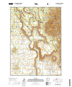
2020 Map of Spodue Mountain
USGS Topo · Published 2020About this map
The Sycan Wild and Scenic River defines the western landscape of this high-altitude Oregon terrain, where the Winema National Forest and Fremont National Forest converge. The topography is marked by significant elevations like Spodue Mtn and the Black Hills, alongside flat-topped features such as Knot Tableland and Cordelia Flat. Numerous named water sources, including Blue Creek Spring, Tim Brown Spring, and Chester Spring, suggest a reliance on these scattered aquifers for land management and recreation. The presence of Wild Billy Lake and Rose Mary Pond indicates a complex network of seasonal and permanent water bodies. Surveyed under the Public Land Survey System, the map details a grid of forest roads like Natl Forest Develop Road 3462 Rd and local connectors such as Oregon Pines Rd, which provide access to more remote locations like Coyote Bucket and Blue Creek Meadows.
Find a feature on this map
45 named features on this map. Tap any name to fly to it.
Don’t see what you’re looking for? This feature index may not catch every label — zoom into the map to look around manually.
Map Details
Editions of this 2020 Spodue Mountain Map
This is the sole edition of this map. No revisions or reprints were ever made.
Other maps of this area

1889 · Klamath
USGS Topo · 1:250,000

1894 · Klamath
USGS Topo · 1:250,000

1955 · Klamath Falls
USGS Topo · 1:250,000

1958 · Klamath Falls
USGS Topo · 1:250,000

1960 · Riverbed Butte
USGS Topo · 1:62,500

1960 · Bly
USGS Topo · 1:62,500

1960 · Beatty
USGS Topo · 1:62,500

1960 · Fuego Mountain
USGS Topo · 1:62,500

1980 · Williamson River
USGS Topo · 1:100,000
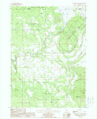
1988 · Riverbed Butte Spring
USGS Topo · 1:24,000